
Sources Around a Yuma Block
A Yuma neighbor lookup begins with sources built for parcels and public activity. The county map shows adjacent polygons and mapped ownership. Assessor records explain the parcel, current owner, and tax-mailing address. City maps add address points, zoning, subdivisions, annexations, and floodplain context. Community Connect shows mapped development cases. Historical directories and Sanborn maps can rebuild an older block, but they describe the publication or map date, not the present day.
| Source | What It Shows About a Block | Access |
|---|---|---|
| City General Map | Address points, streets, zoning, subdivisions, annexations, and floodplains | Free map search and feature click |
| County Public Parcel Viewer | Adjacent parcels, mapped owners, and countywide context | Free browser map |
| Assessor EagleWeb | Owner, situs, mailing address, parcel, and assessment class | Free guest search; office fallback |
| Community Connect | Nearby permits, plans, inspections, and business-license cases | Address search, map browse, and data tools |
| Historic directories | Publication-era names and addresses where street sections exist | Arizona Memory volumes from 1948 through 1963 |
| Neighborhood Watch | Police-supported organizing contact, not a member roster | Contact channel through Yuma Police |
An assessed owner is not the same as an occupant. Situs means the parcel location; the mailing address is where tax notices go. Matching addresses may support owner occupancy, while a mismatch may suggest remote ownership, yet neither identifies all residents. Assessment classes are tax categories, not household rosters. Use the public record for the narrow fact it was made to record.
Map Yuma Neighbors by Parcel
The Yuma County Public Parcel Viewer supplies the best verified radius method. No official automated all-neighbors button was found. Instead, start with one address and click outward. That manual walk is more precise because roads, common areas, multifamily tracts, and unplatted land can sit between ordinary lots.
- Locate the target address and zoom until parcel boundaries and address points are clear.
- Click the target polygon. Record its assessor parcel number, legal description, and jurisdiction.
- Click the parcel on each side and the polygons across the street. Note every parcel number separately.
- Open each parcel in Assessor EagleWeb. Compare owner, situs, mailing address, and assessment date.
- Use the City General Map to confirm city limits, annexation, subdivision, zoning, and flood context.
The flow is simple: address to parcel, parcel to APN, APN to assessor record, then outward to adjacent parcels. Stop at the block edge that fits the question. For a whole named road rather than a tight radius, the Yuma street directory process handles the longer chain.
When EagleWeb is unclear, the Assessor counter at 197 S. Main Street, Suite 201, can help with older assessment snapshots and records not exposed online. Call 928-373-6040 or visit on a weekday from 8 a.m. to 5 p.m. Ask for the parcel record or dated snapshot, not a conclusion about who lives there. County GIS staff at 928-817-5000 can address map context, while the Assessor remains the keeper of assessment facts.
Note: Exact select, measure, and export controls can change, so rely on visible parcel clicks unless the live viewer confirms another tool.
Read Yuma Block Development
The City of Yuma's Community Connect map adds permits, plans, inspections, and business-license cases to the parcel picture. Search an address, browse close map features, and open a case where public attributes are available. A permit applicant or contractor is tied to a project, not automatically to a household.
Jurisdiction comes first. The City General Map shows current incorporated and annexation boundaries. A Yuma postal line does not by itself prove that the City holds the record. County parcel files at Development Services cover many site plans and permits installed after 1975. If a city case is missing online, send a focused request by address, case type, and date to the City Clerk or responsible department.
Nearby zoning and floodplain layers explain why parcel shapes or development patterns differ across a block. Utility layers may add physical context, but they do not reveal customer names. Keep public infrastructure evidence separate from personal identity.
Yuma Neighbor Contact Channels
Yuma does not publish a verified citywide HOA or active association directory. The City Neighborhood Leadership Academy supports residents who form associations, while Neighborhood Watch begins with a resident sponsor and a police organizing meeting. Neither program publishes a private member roster. These are contact channels for civic work, not tools for naming every household.
Neighborhood Leadership Academy
City support for neighborhood leadership and association formation. No public member directory was found.
Neighborhood Watch
Yuma Police organizing route led by a resident sponsor and a meeting. Membership stays private.
Mapped Revitalization Areas
Carver Park, Yuma High, and Mesa Heights appear as city program areas, not household rosters.
Historical community files are broader. Yuma County Library District preserves material from American Legion, Elks, Eastern Star, Kiwanis, Masons, Moose, Odd Fellows, Rotary, VFW, Woman's Clubs, newcomer groups, churches, and garden clubs. Those records may name officers or past members at a dated point. They cannot support a claim about current residence.
Yuma Voter Data Stops Short
My.Arizona.Vote is an identity-verified self-lookup, not a public block browser. It requires county, last name, date of birth, an identification method and number, and verification. A successful self-check can show status, districts, notices, ballot-by-mail status, and participation history. It never shows ballot choices.
Fuller voter data is governed by A.R.S. § 16-168. An authorized request needs a sworn permitted purpose, fee, and review, and may take up to 30 days. Confidential identifiers and protected-address records remain withheld. That means voter data cannot be used as a quick list of Yuma neighbors around an address.
A lawful block study can use published aggregate registration statistics for broad civic context. It cannot turn protected data into names. When a voter source is unavailable, return to parcel evidence, public civic contacts, and historical collections rather than trying to bypass the restriction.
Rebuild Historic Yuma Neighbors
Arizona Memory's digitized Yuma Directory Company run covers 1948, 1949, and 1951 through 1963. Where a volume has a street section, adjacent entries can rebuild a publication-era block. The missing verified 1950 item is a useful caution: a gap in the shelf is not proof that residents vanished. Telephone directories and census records can bridge years.
Seven Library of Congress Sanborn editions span 1893 through 1948. Their sheets show neighboring footprints, uses, and street patterns rather than resident names. Pair a sheet with a dated directory entry, deed, or newspaper item. Historic Brinley Avenue is now Madison Avenue, so old names must be resolved before comparing addresses.
YCLD ephemera and oral histories add local organizations and surnames, while title-company blocks can preserve maps, deeds, surveys, and tax papers. The evidence stays tied to its date. A historical officer, subscriber, or named occupant should never be presented as a current neighbor.
Note: Map adjacency proves spatial closeness, while directory adjacency depends on that edition's arrangement and publication lag.
Compare Yuma Neighbor Sources
Official sources and commercial neighbor tools differ in both purpose and correction path. A county parcel record comes from the office responsible for the assessment fact. A city permit comes from the development record. A commercial compilation may merge public and nonpublic feeds, lag a correction, or present an old address as current. Payment does not make a result official.
| Source type | Best use on a Yuma block | Main limit |
|---|---|---|
| County parcel and assessor records | Identify land, assessed owner, mailing address, and dated parcel facts | Does not list a full household |
| City maps and permit cases | Understand jurisdiction, subdivision, zoning, and nearby development | Applicants and contractors are not presumed occupants |
| Community programs | Reach official organizers for civic participation | No public membership roster |
| Commercial compilation | Possible lead that still needs source checking | May merge namesakes or keep stale addresses |
Correct an official error with its custodian. Private suppression does not erase the underlying deed, assessment, or court index. Important facts should trace to the office responsible for that exact record.
Keep Yuma Neighbor Safety Searches
Public-safety databases are incident or custody sources, not neighbor directories. The Yuma County Sheriff's Office reports page explains how to seek a known report. Its records unit accepts defined requests with identification through the listed in-person, mail, email, phone, and fax channels where allowed. A report should be tied to an event or case, not used to infer everyone on a block.
The official sheriff services screen shows the source for current report procedures.
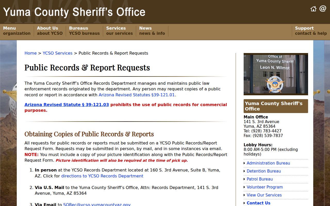
Its role is to verify a specific public record through the keeper, not to create a list of Yuma neighbors.
The Yuma County inmate inquiry is likewise a custody-status index. A name, booking number, date range, and facility may help distinguish a result. The Arizona state inmate search covers the separate state prison system. Custody data is not proof of guilt, and identity plus final disposition should be checked in the court-of-record file.
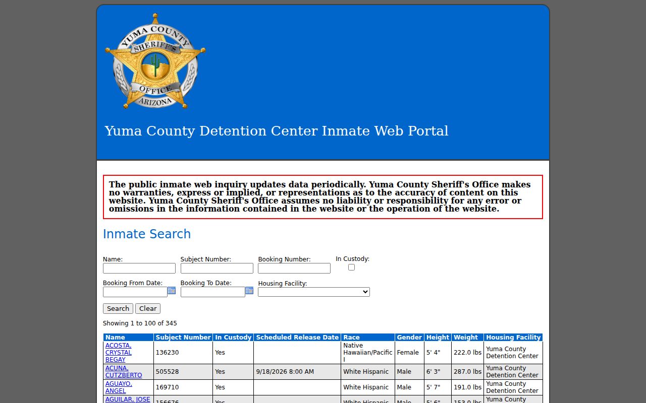
The inquiry belongs only in a precise safety check and never as a proxy for who lives near an address.
Respect Yuma Neighbor Privacy
Parcel maps identify assessed interests, not all occupants. Permit records identify people or entities in a project. Historic directories identify dated listings. None authorizes a claim about every person in a home. Utility customers, delivery data, ballot choices, confidential voter fields, and private association rosters remain outside the public block method.
The Arizona Address Confidentiality Program supplies substitute addresses and mail forwarding to qualifying protected people. Related voter, assessor, recorder, and treasurer rules can shield address information. Never try to reconstruct an address hidden for safety.
Lawful use. Yuma neighbor records support lawful civic and personal research. Never use them to watch, stalk, harass, intimidate, or harm anyone.
When two sources conflict, report the difference. The assessor states an assessment fact, a deed records an instrument, and a directory states a publication-era listing. Each can be accurate within its own date and purpose without proving current residence.